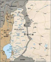
 Galilee (Arabic al-jaleel الجليل, Hebrew hagalil הגליל), meaning "circuit", is a large area overlapping with much of the North District of Israel. It is traditionally divided into three areas:
- Upper Galilee,
- Lower Galilee and
- Western Galilee.
The Western Galilee, also called the "Northern Coastal Plain" strays from north of Haifa up to Rosh Hanikra in the border between Israel and Lebanon.
The Lower Galilee strays from Mount Carmel and Mount Gilboa ridge in the south to the Beit HaKerem Valley in the north. Its eastern border is the Jordan River.
The Upper Galilee strays from Beit HaKerem Valley in the south to the Lebanese border in the north. Its eastern border is the Sea of Galilee and the mountains of the Golan Heights. The "Finger of the Galilee" (Etzba ha-Galil) is a region of the upper Galilee and contains the towns Metula and Qiriyat Shemona and the rivers of Dan and Banias.
Most of the Galilee consists of mountainous terrain, at heights of about 500-700 meters. There are several high mountain such as Mount Tabor. The relatively low tempartures and the large amounts of rain pouring every year made the Galilee a center of blossom and wildlife. The streams and waterfalls (mainly in the upper Galilee), along with vast fields of green and colorful flowers made it a popular tourist attraction in Israel.
At and before the time of Jesus, the region of the Galilee had been populated by Gentiles, people who were of neither Jewish nor Samaritan ancestry. Galilee was not part of Judea proper but at times was under Judean control. Galilee was separated from it by a sliver of the Gentile Decapolis and by the ethnically mixed transitional region Samaria. The cultural and fundamentalist, religious Jews (Judeans), considered the region to be lower than the half-breeds of Samaria and therefore, morally, spiritually and physically "unclean".
More...


No comments:
Post a Comment